Fresh weather warnings have been issued by the Met Office across the UK for ice and rain this week, following last week’s snowfall during Storm Goretti.
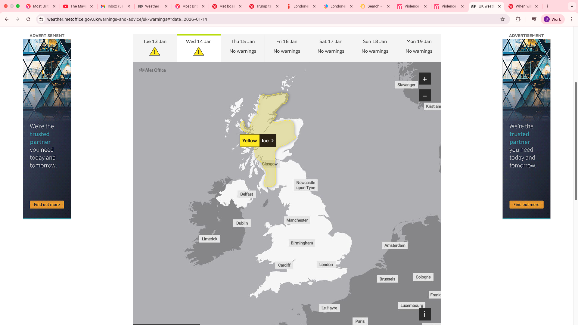
Icy conditions are expected to cause travel disruptions in parts of Scotland from 8pm on Tuesday night till 10am on Wednesday morning, according to the national forecaster.
The regions impacted by this weather warning include: Central Tayside and Fife, Grampian, Highlands and Eilean Siar, southwest Scotland, Lothian Borders and Strathclyde.
Forecasters have predicted that “clear spells will lead to ice developing on untreated surfaces on Tuesday night”, particularly in areas where there has been a lot of melted snow by day and also “where wintry showers move inland from the west overnight”.
Roads, pavements and cycle paths are expected to contain icy patches and the Met Office have advised pedestrians to leave the house at least five minutes earlier than normal to avoid rush and risk of accidents, slips and falls on icy surfaces.
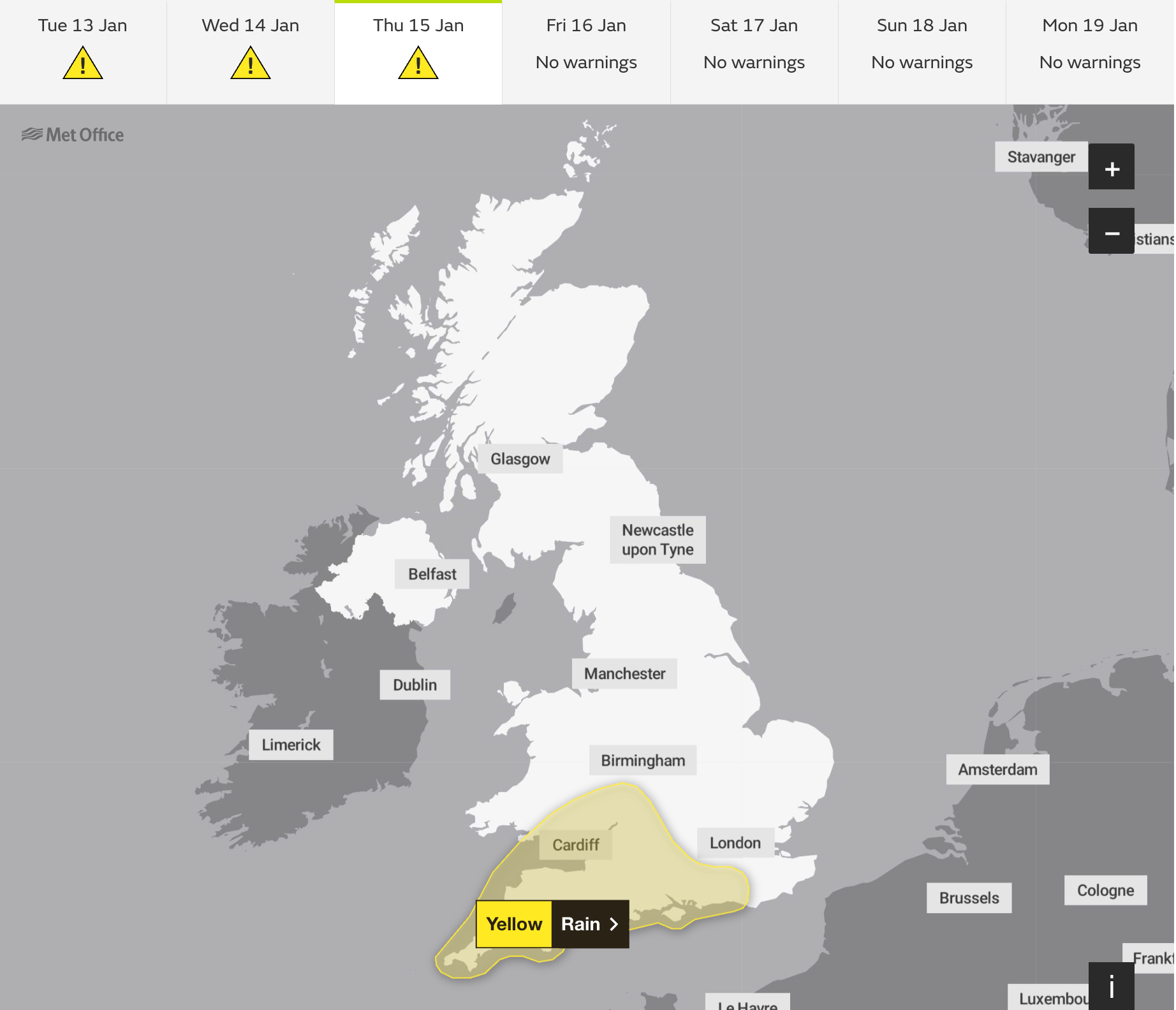
Another yellow weather warning of rain has been issued for Thursday in South West England with potential flooding expected. The Met Office has said: “A deepening area of low pressure will migrate northeastwards across England and Wales on Thursday. Whilst the exact track is uncertain, rain will become persistent and heavy through the day, before clearing to the north through the evening and night.
“Accumulations of 20-40 mm are expected fairly widely, in some places falling in just a few hours, with the potential for 40-70 mm in a few isolated spots, this most likely across parts of southwest England. Given the saturated ground, this may lead to some surface water flooding.”
The areas covered by this warning include London and southeast England, southwest England, Wales and the West Midlands.
The Environment Agency has also issued three flood warnings for England, along with 40 flood alerts in areas where flooding is possible.
It comes after heavy snow fell across the UK last week, burying some areas under up to 30cm amid warnings of the “worst snowfall in a decade”.
Storm Goretti swept across the Channel to the UK on Thursday evening and into Friday, battering the Isles of Scilly and Cornwall with hurricane-force winds and covering much of the UK with snow. The storm brought gusts of almost 100mph and a rare red warning for “dangerous, stormy” winds in the south-west of England last week.

Met Office five-day weather forecast
Today:
There will be outbreaks of rain, which is expected to be heavy at times. Later, rain will clear in the north to give sunny spells in the afternoon with scattered showers turning wintry over the hills in Scotland. The forecasters predict cold weather in the north, but milder temperatures in the south.
Tonight:
Forecasters predict scattered showers will continue in northern Scotland tonight. Rain is likely to linger across southern England. There will be clear skies elsewhere, with a few fog patches in the south and a widespread frost.
Wednesday:
Wednesday is expected to be cloudy in the south with outbreaks of rain and drizzle. They predict it to be a dry start elsewhere, before a band of rain moves into the west later in the afternoon.
Outlook for Thursday to Saturday:
Further rain is forecast through the coming week. Temperatures will be around the average for January in the south, but colder in the north. A spell of heavy rain and strong winds are possible on Thursday night.
