Every county in the Republic of Ireland will be under an orange weather warning at some point on Tuesday, according to upgraded advisories from Irish forecasters.
The entire island of Ireland will be under a weather advisory on Tuesday, as Storm Bram brings very strong winds and high coastal water levels.
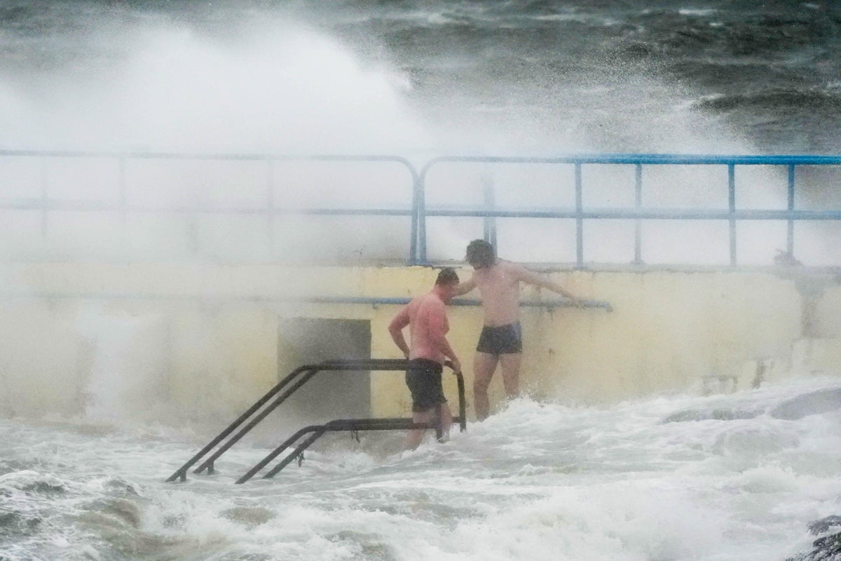
After a week of persistent rain, Irish forecasting agency Met Eireann said soils across the country are already highly saturated and many rivers are approaching bank full conditions, so any additional rainfall is likely to result in surface and river flooding.
The track of the storm means forecasters have put in place rolling orange wind warnings throughout the day.
Forecasters are warning of flooding of low-lying coastal areas especially during high tide, wave overtopping, difficult travel conditions, flying debris, and potential power outages.
The storm has already resulted in some travel disruption with Emerald Airlines has “preemptively” cancelled a number of flights from its Tuesday schedule, according to Dublin Airport.
The airport said other airlines have indicated “that they continue to monitor the situation”.
An orange warning for Carlow, Kilkenny, Wexford, Wicklow, Cork, Kerry, Limerick, Tipperary, and Waterford is in place until 3pm.
A separate orange warning for all of Connacht, as well as Cavan, Monaghan, Clare, Dublin, Kildare, Laois, Longford, Louth, Meath, and Offaly was announced for 11am to 9pm.
And a third orange warning for Donegal was announced for between 2pm and 9pm.
Met Eireann forecaster Gerry Kelly said it was a day to be “very, very careful”.
He told RTE’s Morning Ireland: “It is going to be a very windy day everywhere, and there is certainly a possibility for all areas to reach those levels for a time.”
He particularly highlighted a risk of coastal flooding in the south of the country during high tide on Tuesday morning.
Meanwhile, warnings in Irish waters have also been upgraded with a status orange storm warning for all coasts and on the Irish sea applying until midnight.
In addition, two red marine warnings are in place between 8am and 3pm, combined with a similar advisory between midday and 8pm from Loop Head to Erris Head to Malin Head.
Forecasters are advising that south to southwest winds will occasionally reach violent storm force 11.
In Northern Ireland, the UK Met Office has issued a yellow wind warning for the entire region between 9am and 9pm.
The poor weather has resulted in the closure of the Belfast Christmas Market on Tuesday.
Organisers said: “We recognise this may be disappointing, however the safety of our visitors and traders is of the utmost importance.
“At the moment the plan is to reopen on Wednesday December 10, however this is weather dependent.”
The Met Office advised the public to expect delays to transport services and further warned that cancellations are possible.
It added that there was a chance of injuries and danger to life from flying debris, as well as damage to buildings and power outages.
Forecasters said gusts of around 50-60 mph are possible fairly widely across the region, and potentially in excess of 70mph for some exposed headlands and areas of high ground.
