Yellow weather warnings are in place across the UK as heavy showers are set to batter parts of the country over the weekend and into the beginning of next week.
The Met Office has warned that a developing area of low pressure will move across southern and central parts of the UK on Saturday, bringing bands of heavy rain and gusty winds, particularly across Wales, the Midlands, and southern England.
The forecaster said we could see disruption and possible flooding from the early hours of Saturday morning, with as much as 80mm of rainfall expected in the southwest of England and Wales.
The North and South Downs in England can expect to see closer to 50-60mm of rainfall, along with strong winds that will be particularly gusty in coastal areas, forecasters said.
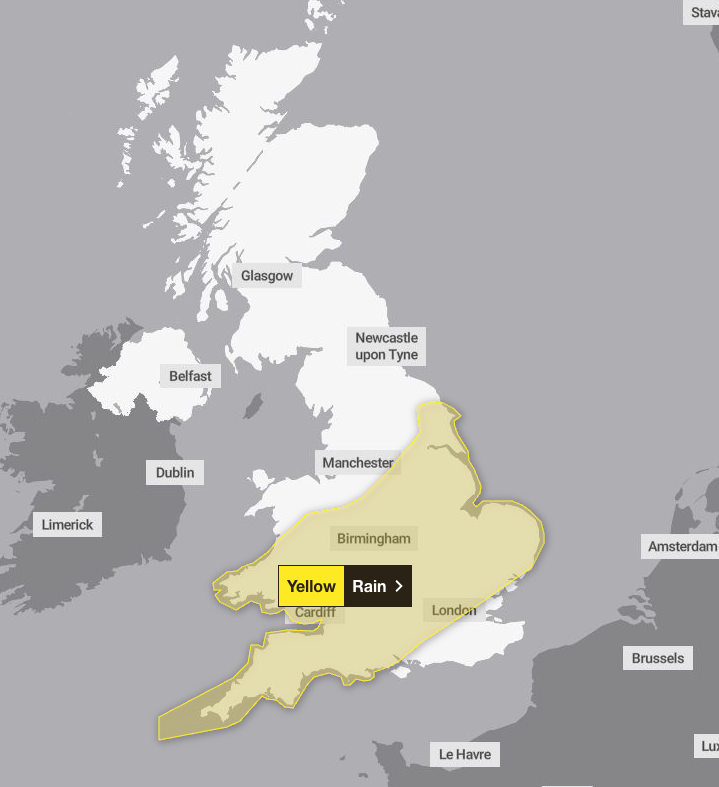
A yellow weather warning for rain is in place from 6am on Saturday to midnight, spreading across the East Midlands, eastern England, London, southern England, southwest England, Yorkshire and Wales.
The Met Office said as much as 60-80mm of rain could fall over high ground, with potential for 20-30 mm to fall fairly widely.

There are currently no weather warnings in place on Sunday as the conditions are expected to turn drier and brighter – although temperatures are likely to be colder, hovering at around 7C in the south and 3C in Scotland.
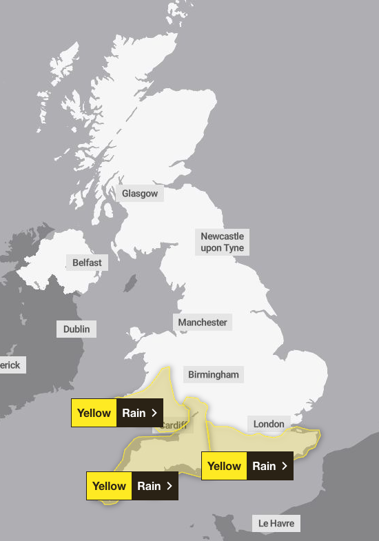
But as we move into the new week, the rain is expected to return, with three yellow weather warnings in place. The warnings cover Wales and southwest England from midnight until 3pm on Monday, and London and South East England from 8am on Monday to 6am on Tuesday.
The heaviest rainfall is likely over parts of the south and southwest England and south Wales, according to the Met Office. It said 20-30 mm of rain could fall quite widely across the wider region, but 60-80 mm is likely to accumulate over some windward-facing high ground in south Wales and the high ground of Dartmoor.
Forecasters are predicting around 40-50 mm of rain to accumulate across the higher parts of Exmoor, Dorset, the Mendips and Cotswolds, and as much as 50-60 mm over the North and South Downs.

Forecasters warned there is some chance of flooding in the affected areas, which they said could cause disruption to travel networks and infrastructure.
The Met Office added that strong southwesterly winds will accompany the rainfall, particularly near English Channel coasts.
Chief meteorologist Jason Kelly said: “While the exact track of the low remains uncertain at this time, there is a clear signal for strong winds and periods of heavy rain, which could lead to surface water flooding and delays to road and rail travel.
“Rain will also push into northeast England during Saturday, some of which could fall as snow over higher ground when the system meets colder air coming down from the North.
“Sunday will be drier and brighter, albeit colder, for many areas with blustery winds lingering near some North Sea coasts. Expect widespread frost overnight into Monday before the next weather system approaches.”
The weather is predicted to remain unsettled with wet and windy conditions set to continue for the week ahead, with the occasional drier and milder spell.
