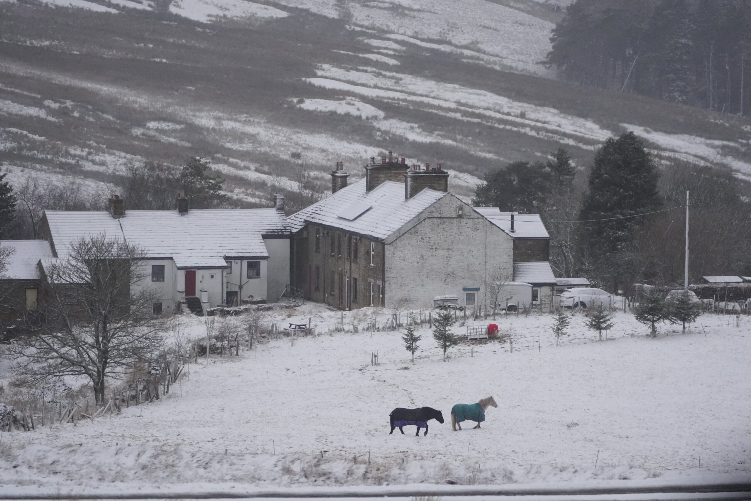
A cold snap is forecast to bring freezing temperatures and a chance of snow after downpours from Storm Claudia caused widespread flooding in parts of the UK.
The storm particularly affected Wales, where a major incident was declared in Monmouthshire. People were evacuated from their homes in the town of Monmouth after the River Monnow burst its banks.
Rainfall of 119.6 mm was recorded in the 12 hours to 6am on Saturday at a Natural Resources Wales rain gauge at Tafalog in Gwent. In Suckley, Worcestershire 80.6mm was recorded over the same period.
But as the clear-up from the flooding gets underway, a plunge in temperature could bring icy conditions in the coming days.
What is causing the cold snap?
A significant drop in temperatures is expected due to a change in wind.
Recent mild spells have been caused by southerly wind, but this pattern is set to change and, by Monday, colder air in the north will sweep southwards and bring winds from the Arctic.
According to Met Office deputy chief meteorologist Dan Holley, the cold snap will be triggered by high pressure to the northwest.
He said this pressure “will drive a cold northerly flow from the Arctic”, bringing with it “much colder conditions than of late”.
Temperatures could dip as low as minus 7C in places next week, according to the Met Office.
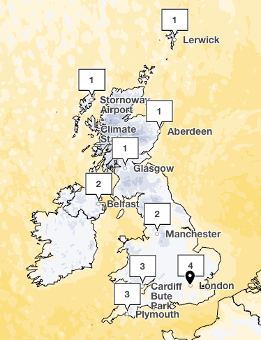
“It’s certainly going to turn much colder over the next couple of days, there will be an eight to 10 degree drop in temperature, you will be struggling to get double figures,” Met Office meteorologist Simon Partridge told The Independent.
“We will probably see our first widespread countrywide frost on Monday morning and the lowest temperatures will be somewhere between minus 5C and minus 7C.”
When and where will it snow?
There is potential for it to snow in areas exposed to this northerly wind from the Arctic.
“On Tuesday, there is a small area of low pressure that is going to bring in a band of rain, sleet and hill snow,” Mr Partridge said.
This is likely to hit northern parts of the UK, he explained.
Wintery showers – with a mixture of rain, sleet and snow – could hit Scotland, Northern Ireland, the North Yorkshire Moors, west Wales and the moors of south-west England.
The Met Office has said snow could fall in these areas on Tuesday and Wednesday. But it will be dry and sunny for most areas on Thursday with cold and overnight frosts.
Are there any weather warnings?
The UK Health Security Agency (UKHSA) has issued a cold weather warning ahead of the drop in temperatures.
The alert is in place from 8am on Monday until 8am next Friday. It covers the East Midlands, West Midlands, North East, North West and Yorkshire and The Humber.
UKHSA explained alerts are issued when cold weather is forecast that could lead to significant impacts on health.
In addition, Mr Holley also warned “it is possible warnings may be issued for snow and ice at times”.
