Just days after two typhoons battered the Philippines killing hundreds, a top meteorologist has warned the ravaged country could face further damaging storms as a result of the La Nina weather system.
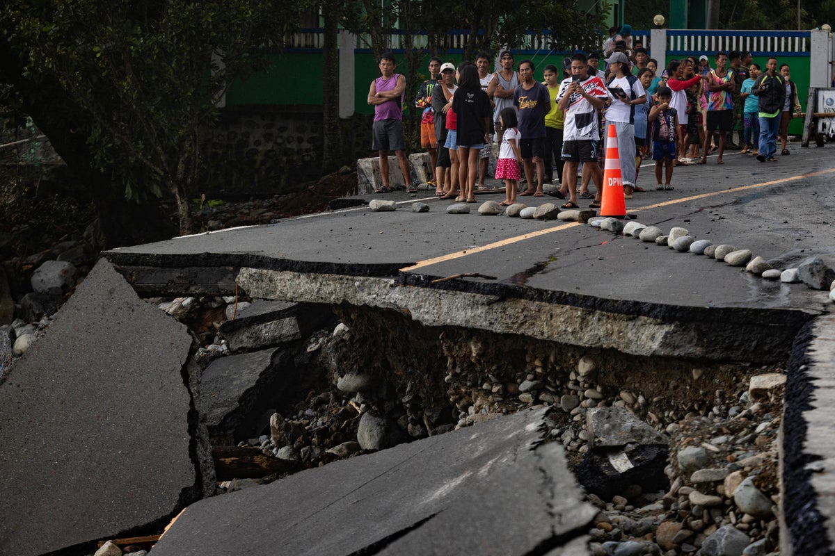
More than one million people were displaced from the southeast Asian country as successive storms – Typhoon Kalmaegi and Super Typhoon Fung-wong –brought untold devastation to the region, killing more than 250 people in total.
As authorities work through the flattened structures of the Philippines’ main island in the north, Luzon, a leading weather forecaster has warned the country could face more tropical storms before the end of 2025 – even though La Nina is expected to be weaker and shorter-lived than usual.
Jason Nicholls, lead international forecaster with AccuWeather, told The Independent he is “concerned that the Philippines is not out of the water yet for another tropical impact or two”, noting that the country has “already been hit two times recently”.
During La Nina, which occurs during the cooling phase of the sea surface temperature, the wind shear – a phenomenon that hampers the formation and strengthening of hurricanes –is typically weakened.
This allows for “conditions that may seed hurricanes” and results in a “more active and a longer hurricane season”, explained Dr Samantha Burgess, deputy director of the Copernicus Climate Change Service (C3S).
La Nina therefore brings with it worsening hurricane and typhoon impacts in the Atlantic and Pacific, and forecasters say its impacts are likely to have contributed to the low-wind shear environment which allowed Hurricane Melissa to devastate Jamaica and other parts of the Caribbean in October.
The Atlantic has since been unusually quiet, and Mr Nicholls says his concerns are “mostly around the Philippines”. He added: “In the last five days they got hit twice, and they had a couple impacts even in October, so that’d be an area there would be a little bit of concern for”.
But he also says eastern Australia, which often suffers “pretty heavy rains” during La Nina periods, could face severe weather impacts.
“I’d be a little concerned there could be some flooding going forward over the next couple months in eastern Australia,” he said, adding this could come more towards the “late November-December time period”.
Why is La Nina milder than usual?
La Nina, the cooler and costlier flip side of the El Nino, arrived in October to warp global weather systems, typically bringing with it heavy rains, and a turbocharged Atlantic hurricane season. It officially occurs when certain parts of the Central Pacific Ocean cool by 0.5C (0.9F) compared to normal.
It brings with it varied and often dramatic weather conditions, strengthening the hurricane season, causing torrential rain in some parts and cooler, drier conditions in others.
“When we’ve had La Nina events in the past, we’ve seen more likely than not record levels of rainfall in eastern Australia, in the Indo Pacific, in southern Africa, in northern South America and southern central America,” Dr Burgess said.
“La Nina right now is a very mild event, so [the sea surface temperatures] are just below average, rather than significantly below average. And the models also suggest that it will be quite a short-lived event as well,” she added.
Mr Nicholls added that La Nina “overall should be on the weaker side”, and he is “not sure how extreme the impacts will be”.
But climate scientists do not have a clear answer to why the La Nina conditions are expected to be milder than usual.
“We don’t often understand the drivers of how significant either an El Nino or a La Nina event will be,” Dr Burgess continued.
“So we can predict it ahead of time, and we can predict, with some uncertainty, how the climate projections and seasonal predictions suggest the event will evolve.
“But this particular event, all the models agree that it won’t be a severe event in terms of the drivers that make a particular event severe.”
