The UK is set for a spell of bad weather on the approach to the Halloween weekend, with trick-or-treaters urged to prepare for wet and windy conditions.
While Hurricane Melissa has caused destruction in the Atlantic, forecasters have been keeping an eye on developments on the other side of the ocean.
Strong winds and outbreaks of rain are expected in western parts of the UK, according to the Met Office in partnership with Met Éireann and KNMI in the Netherlands, which are monitoring the forecast closely.
At the moment, the weather does not meet the criteria for a named storm, but the situation is still developing and remains under review, forecasters said.
Heading into the weekend, the weather pattern remains “highly changeable”, the Met Office said. While some areas may see brighter and drier conditions, other parts of the country may be subjected to further heavy and blustery showers.
The Met Office added: “The jetstream is currently very amplified and wavy, which means that low pressure will dominate steering bands of showers across the UK.”
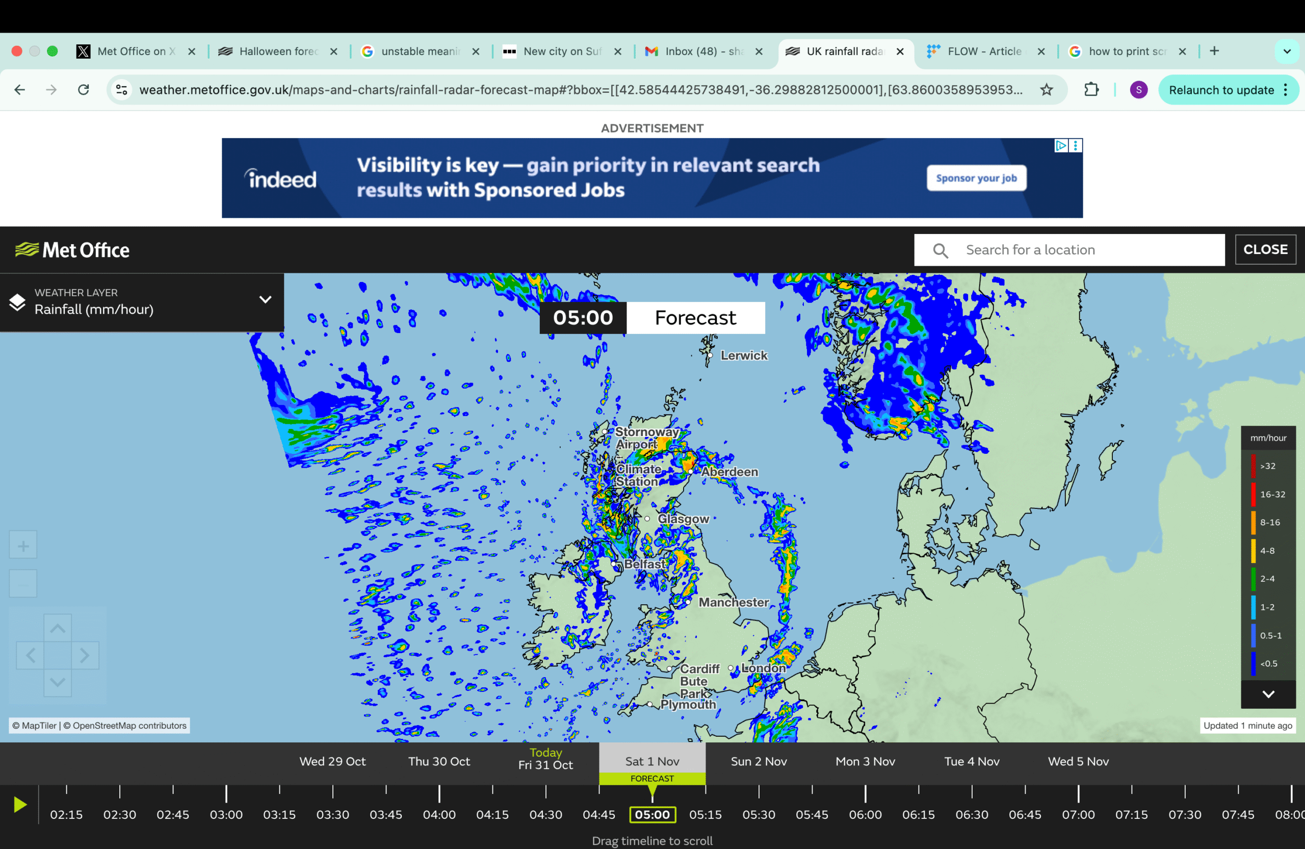
Further bands of rain are likely to run east or north-east across many areas through Saturday, although details are unconfirmed. There will be some bursts of sunny or clear spells in between periods of showers.
Many will experience another windy day, with the chance of coastal gales developing in the West. Daytime temperatures are predicted to be relatively average for this time of year, whilst it may become milder at night.
More sunshine and showers are expected to continue on Sunday, with rain more prevalent in the first part of the day. During the afternoon, skies are likely to cloud over in the West, with some rain moving in from the Atlantic by the evening.
Met Office deputy chief meteorologist Tom Crabtree explained: “It looks like late on Sunday and into early Monday, a low-pressure system containing the remnants of what will then be ex-Hurricane Melissa will move across the far north-west of the UK.
“This appears to be a fairly typical autumn low-pressure system for the UK, introducing some milder air and bringing further spells of rain, which will be heaviest over western hills. There remains some uncertainty in the exact track of this low at this range, however, it looks set to usher in further unsettled weather next week.”
The public is advised to stay up to date with the latest forecasts and weather warnings, as the situation is unstable and could change at short notice.
