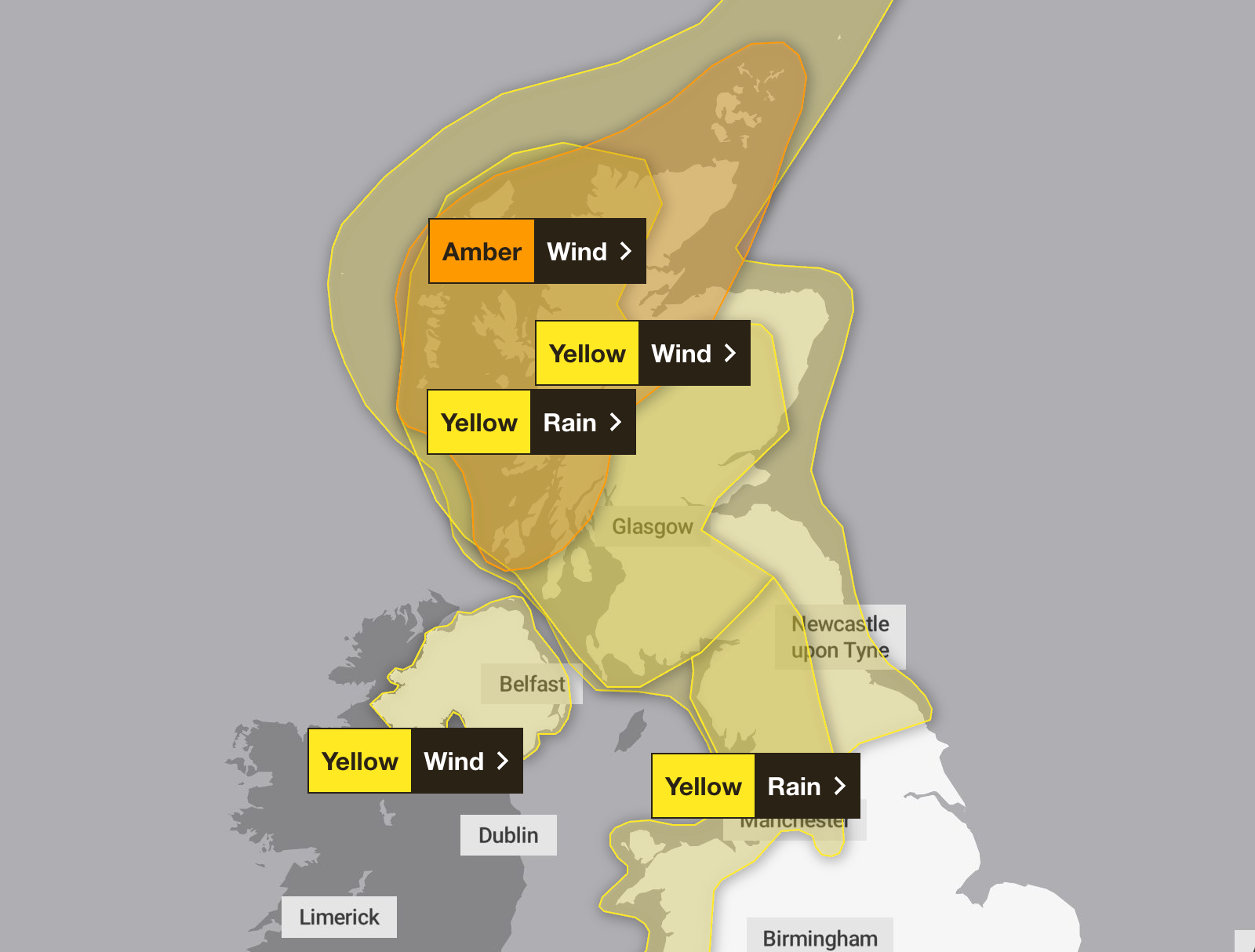
The remnants of Hurricane Humberto and Imelda are bringing the first storm of the season to the UK this week, as an amber weather warning comes into force on Friday.
The Met Office has issued five weather warnings for Friday, three of which will continue into Saturday. The amber warning, which hasn’t been issued since Storm Floris in August, is in place in areas of Scotland, including Grampian, Highlands and Eilean Siar, Orkney and Shetland, and Strathclyde.
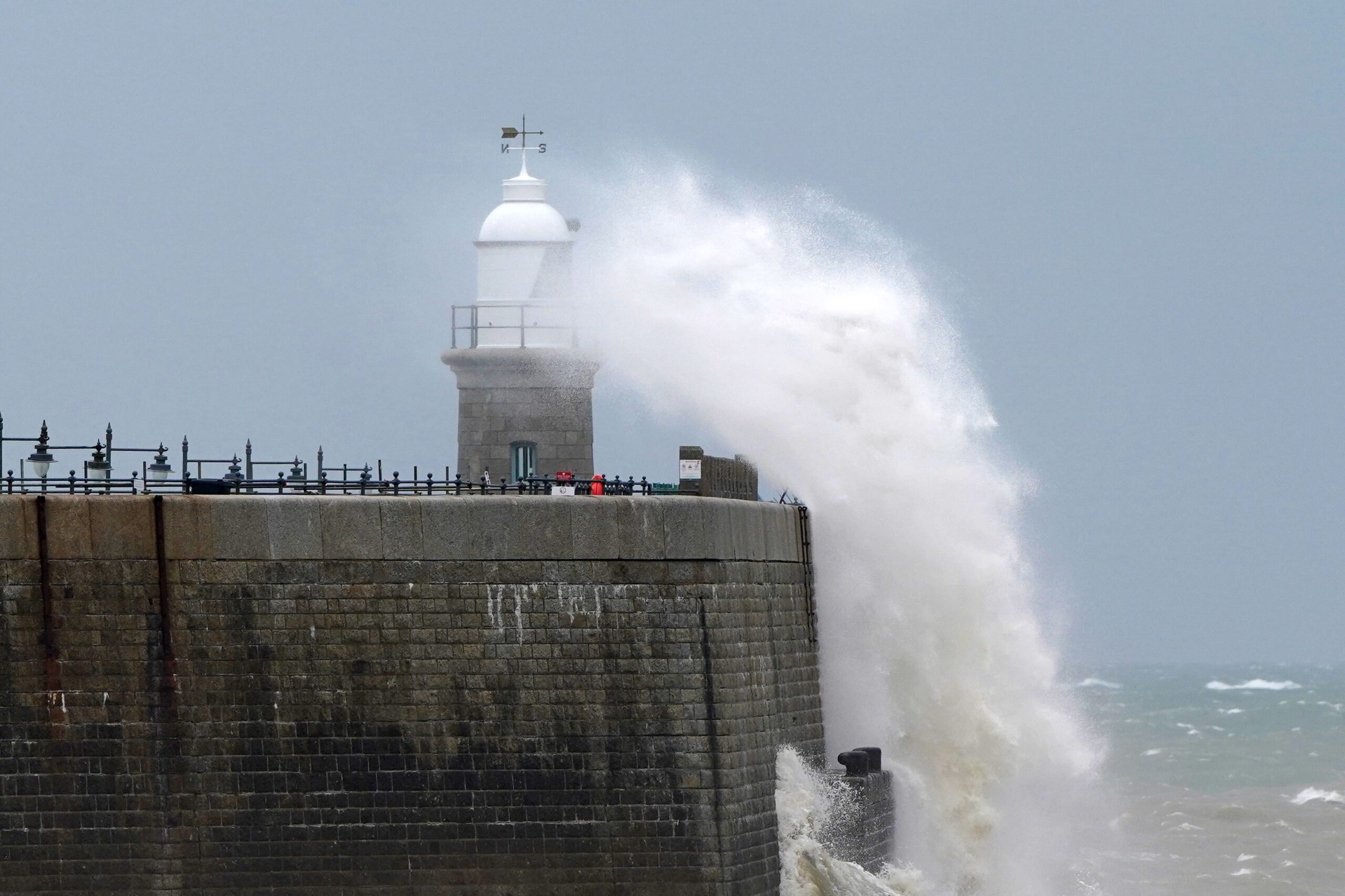
Storm Amy, the first named storm of the season, is currently developing in the Atlantic and will bring impactful wet and windy weather to much of Scotland, northwest England and northwest Wales, with the possibility of gusts in excess of 95mph, the Met Office said.
Met Office chief forecaster Neil Armstrong said: “Storm Amy brings a risk of power cuts and damage to buildings and trees. Gusts around 60 to 70mph are expected more widely in the Amber warning area, in what will be an impactful autumn storm for many in Scotland.”
The Met Office has warned of power cuts, damage to buildings and homes, closed roads, bridges, railway lines, and flying debris, which poses a risk to life, are possible.
A yellow weather warning is in place in areas of west and northwest Scotland from 5pm on Thursday, with heavy rain and wind expected for areas in Central, Tayside and Fife, and Strathclyde. Northern Ireland also had a yellow warning issued, as outbreaks of heavy rain are likely at times.
Met Office deputy chief meteorologist Tom Crabtree said: “Although there is still some uncertainty about the exact track Storm Amy will take, the system will bring gale force winds across northern and western regions.”
On Storm Amy’s arrival, the strongest winds will be accompanied by spells of heavy rain, which the Met Office said will be most persistent across parts of Scotland.
“The storm’s evolution is being closely monitored, with its development influenced by the remnants of Hurricanes Humberto and Imelda over the tropical Atlantic,” the Met Office said.
“These systems have accelerated the jet stream, contributing to the formation and intensification of Storm Amy.”
On Thursday morning, patchy, dense fog fell at the bottom of the country, in areas of East Midlands, East of England, London and South East England, South West England and West Midlands, where there was expected to be reduced visibility and some potential travel disruption. The yellow weather warning was issued by the Met Office 7.15am and lifted at 10am.
Here is the weather forecast for the UK for the coming week, according to the Met Office:
Today
Widely cloudy in the north and west with spells of rain becoming widespread, persistent, and heavy by the afternoon. Drier in the southeast with some sunshine, though turning cloudy through the afternoon. Increasingly windy with gales possible in the west.
Tonight
Windy with rain spreading eastwards, clearing all but the Northern Isles and far southeast by dawn. Drier with more settled conditions to follow as winds briefly ease. Mild for most.
Friday
A briefly settled morning, before Storm Amy moves in rapidly from the west. Widely windy by the afternoon with severe gales in the north and heavy outbreaks of rain.
Outlook for Saturday to Monday
Windy on Saturday with coastal gales and blustery showers or longer spells of rain. Winds slowly easing from Sunday, with sunshine and showers into the new working week. Feeling fresh.
