The UK is set to feel the double effects of Tropical Storm Fernand and Hurricane Erin over the weekend as they move across the Atlantic.
The Met Office has issued a yellow weather warning for rain across parts of the country as it warns of an “unseasonable” rainy weekend.
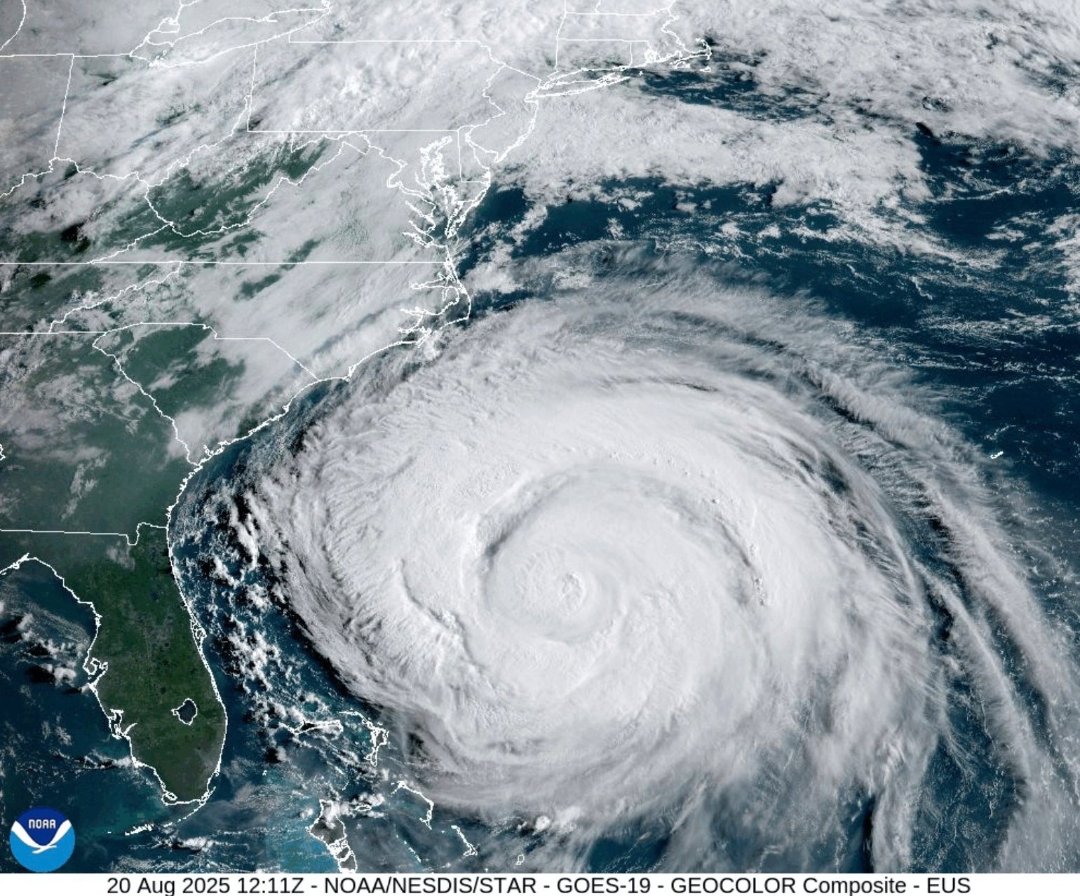
Hurricane Erin hit the east coast of the US and Canada last week after first descending on the Caribbean. Meanwhile, Tropical Storm Fernand has remained over the Atlantic and posed little risk to land.
While both have been downgraded by authorities and are dissipating over the ocean, they will send low pressure systems towards the UK in the coming days. This will bring unsettled and rainy conditions, the Met Office has confirmed.
Met Office meteorologist Alex Burkill said this will be caused by “a couple of low pressure centres” currently over the Atlantic interacting with the jet stream.
This is a column of air high up in the atmosphere that causes changes in wind and pressure at that level. The effects of this are then felt nearer the surface.
He said: “It looks like these low pressure centres are going to get closer towards the jet stream as they push their way across the Atlantic, then a sort of new feature is going to develop with these low pressures joining it and all amalgamating together.”
“That low pressure system is going to run across the jet stream, get a but more oomph … and then make its way towards us as a relatively deep layer of low pressure.”
This is set to bring “unseasonable” weather, Mr Burkill added, by Saturday 30 August.
Up to 10 to 20mm of heavy rain and gusts in excess of 50mph are expected in some areas this weekend, The Met Office has warned, particularly along the coast and on high ground.
It will mark the end of a dry spell for the UK after back-to-back heatwaves have led to what will likely be declared the country’s hottest ever summer.
Here is the Met Office’s forecast for the coming week:
Today
Sunshine and scattered showers for many, these heavy and thundery at times with the possibility of hail. Breezy, especially in the West, and feeling cooler here, but warmer in sunny spells in the East.
Tonight
Becoming largely dry with clear spells across the East and South East. Elsewhere, showers likely to become more organised in the South West and North West. Breezy for most.
Friday
More rain across the South West with heavy and thundery showers, these moving eastwards across southern counties. Elsewhere any showers easing in the afternoon with temperatures around average.
Outlook for Saturday to Monday
Staying unsettled this weekend with further spells of rain and showers. Widely wet and windy on Saturday, but with some brightness returning on Sunday. Temperatures remaining around average.
