Hurricane Erin has battered North Carolina’s Outer Banks with strong winds and waves and is now moving north and out into the Atlantic.
The Category 2 storm continues to produce dangerous surf and rip currents along the East Coast and is expected to do so over the next few days, according to the National Hurricane Center. The hurricane, which is forecast to weaken and become a post-tropical storm over the weekend, is not predicted to make landfall in the U.S.
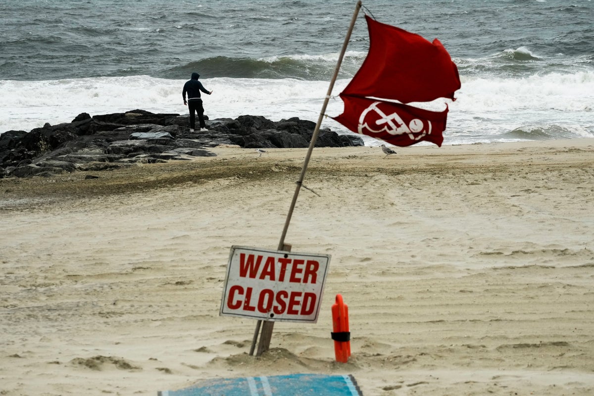
New Jersey officials have declared a state of emergency and advised residents to stay out of the water on Thursday and Friday due to “life-threatening” rip currents caused by the hurricane.
As Erin’s outer bands brushed the Outer Banks, water flooded the main route connecting the barrier islands and a few stilted homes perched precariously above the beach. More than 2,000 people were evacuated from Ocracoke Island by ferry, according to the governor’s office.
The hurricane formed on August 11 from a tropical wave that moved across the Cape Verde Islands and was upgraded on August 15, becoming one of the fastest-intensifying on record.
There are now three other areas of concern being watched in the Atlantic that could develop into tropical storm systems.
Hurricane Erin: Where things stand on Thursday evening
- Hurricane Erin, a Category 2 storm, has battered North Carolina’s Outer Banks with strong winds and waves, causing localized flooding and prompting the evacuation of over 2,000 people from Ocracoke Island.
- The hurricane is now moving north and out into the Atlantic, continuing to produce dangerous surf and rip currents along the East Coast, with warnings extending from the Carolinas to New England.
- Despite initial concerns, the Outer Banks largely avoided widespread destruction, with no significant structural damage reported to homes or businesses, though sections of Highway 12 were closed due to flooding and dunes were breached.
- Officials in New Jersey declared a state of emergency, and videos on social media show storm surge flooding in some streets near the ocean.
- Swimming bans were imposed on beaches from New York City to Bermuda due to life-threatening rip currents, with authorities urging residents to stay out of the water.
- Hurricane Erin, which formed on 11 August and rapidly intensified, is forecast to weaken and become a post-tropical storm over the weekend, with no predicted landfall in the U.S.
- Meteorologists are closely monitoring three other areas of concern in the Atlantic that could develop into tropical storm systems, with one having a high chance of becoming a tropical depression within seven days.
Two homes in North Carolina teetered on the brink as Erin passed by
Two homes on North Carolina’s Outer Banks are teetering on the brink, their days seemingly numbered as they face the relentless Atlantic.
Since 2020, 11 neighbouring properties in the area have already succumbed to the ocean’s advance. While swells from distant storms like Hurricane Erin exacerbate the immediate danger, the underlying threats are constant: escalating beach erosion and the pervasive impact of climate change are steadily pushing the coastline inwards.
Continue reading…
What was the impact on the East Coast?
Hurricane Erin battered North Carolina’s Outer Banks with strong winds and waves that flooded part of the main highway and surged under beachfront homes as the monster storm inched closer to the mid-Atlantic coast.
Forecasters predicted the storm would peak Thursday and said it could regain strength and once again become a major hurricane, or Category 3 or greater, but it was not forecast to make landfall along the East Coast before turning farther out to sea.
Read on…
Hurricane Erin mapped: Tracking the course
Here’s a look at Hurricane Erin’s path past the East Coast of the U.S.
NASA wants your photos of hurricane damage — here’s why
The space agency, in collaboration with the Global Learning and Observations to Benefit the Environment (GLOBE) Program, a science and education initiative, is spearheading a new Response Mapper project.
Read on…
Watch: National Hurricane Center tracking three other areas of concern
Watch: Waves crash into Wildwood, New Jersey
Erin still a large hurricane — twice the size of the average storm
Hurricane Erin, formed nearly a week ago, remains an unusually large storm, spanning over 600 miles (965 kilometres) – double the size of an average hurricane – despite fluctuating intensity.
As of late Thursday morning, the hurricane centre reported Erin as a Category 2 storm, maintaining maximum sustained winds of 100 mph (160 kph). It is 285 miles (455 kilometres) east of Cape Hatteras.
The hurricane centre is also monitoring two tropical disturbances further out in the Atlantic. These ‘Cape Verde’ storms, developing over vast warm ocean waters, are historically among the most perilous to North America.
Watch: Flooding in downtown Margate, New Jersey
A video posted to X by TV news journalist Jason Evans appears to show the streets of Margate, New Jersey, inundated with the storm surge from Hurricane Erin.
New threat of coastal erosion from Erin
Coastal communities along North Carolina’s Outer Banks faced an anxious Thursday morning as waves were estimated to reach heights of 5.5 meters (18 feet). The region, characterised by its low-lying sand dunes just a few feet above sea level, is particularly susceptible to the destructive power of storm surges, which can carve new inlets, wash vast amounts of sand and debris onto roads, and even damage infrastructure.
However, Dare County Manager Bobby Outten offered a measure of relief, stating that one of their gravest fears – the formation of new inlets – had not materialised with the storm Erin. Crucially, no significant structural damage was reported to homes or businesses.
“All in all, it’s not as bad as it could have been,” Outten said. “Hopefully, the worst of it is behind us.”
The Hatteras Island Rescue Squad, a volunteer group, also confirmed they received no calls for rescues from Wednesday night through Thursday morning.
Despite the avoided catastrophe, the powerful waves did breach dunes on Hatteras and Ocracoke Islands, leading to the closure of sections of Highway 12, the area’s primary thoroughfare. Ocracoke’s vital connection to its ferry terminal was also severed.
