Cape Verde hurricanes, named for the group of islands about 450 miles (725 kilometres) off the west coast of Africa, typically form from clusters of thunderstorms that move off the continent and into the Atlantic Ocean.
Fueled by thousands of miles of ocean water above the 80-degree Fahrenheit (27-degree Celsius) temperature needed to fuel hurricanes, Cape Verde storms are some of the most dangerous that threaten North America.
The National Hurricane Centre says about 85 per cent of all major hurricanes, classified as Category 3 and above, start in the region.
“They are the media stars and certainly get a lot of attention because you can track them for a long time,” said Jeff Masters, a meteorologist for Yale Climate Connections.
But they are also a rare threat. Less than one out of every 10 storms crashes into the U.S.
The rest either fall apart or are curved out to sea by the north and east steering winds that normally prevail over the Atlantic.
Now is the time to turn to the east
Conditions need to be just right for Cape Verde storms to form and grow, keeping them mostly confined to August and September.
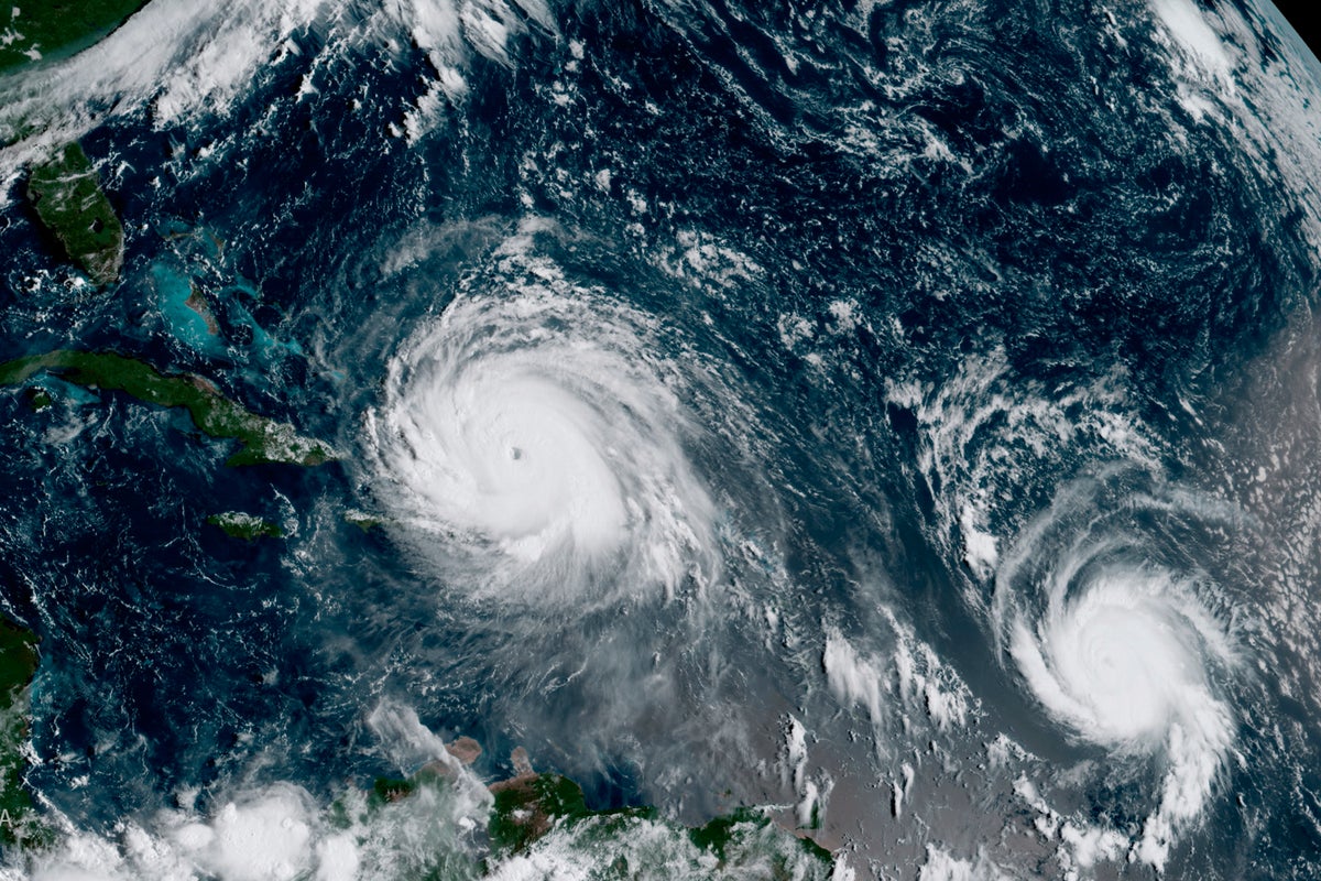
Hurricane Erin is a Cape Verde storm. The National Hurricane Centre is watching two more clusters of storms to the east of Erin that could develop into tropical storms.
But the atmosphere is too complex to know how strong those storms can be if they develop or whether any of them will threaten the U.S. Forecasters begin to lose confidence in their ability to predict the future of any specific storms more than a week out. It takes at least 10 days for a potential hurricane to cross the Atlantic Ocean.
Warm weather and light winds help Cape Verde storms grow
Cape Verde storms start over Africa, where the hot, dry air in the Sahara and the hot, humid air over the Gulf of Guinea clash and create clusters of thunderstorms that move off the continent.
The warm water is the first ingredient. Hurricanes also thrive with light winds above them that won’t blow the thunderstorms away from the centre.
“They are the strongest because they have the most time to develop. The other storms can crash into land too early,” Masters said.
Researchers have spent the past several years studying the ocean and atmosphere in the far eastern Atlantic to get a better idea of why some storms form and some don’t.
In recent years, scientists have realised that dry air and dust from the Sahara in Africa, blown into the Atlantic from the east, can lessen the high humidity hurricanes need and inhibit their development. The dust can travel all the way across the ocean and settle on cars and windows on the U.S. East Coast.
“They travel about a mile above the surface, the winds are very strong, and the air is dry and hot. That’s a trifecta that suppresses hurricane activity,” Jason Dunion, a scientist at the University of Miami’s Cooperative Institute for Marine and Atmospheric Studies, told the university.
One or two hurricanes a year are Cape Verde storms
Some years may not see a Cape Verde storm at all. Some can see as many as four or five. But on average, about one or two hurricanes a year are classified as Cape Verde storms, according to the National Hurricane Centre.
And they aren’t the only storms to hit the U.S. The Weather Channel analysed hurricanes since 1995 and found only nine of the 60 that struck the U.S. were the ones that track all the way across the Atlantic.
The storms you remember
The list of famous Cape Verde hurricanes has a lot of overlap with the list of the most memorable, powerful and deadliest hurricanes.
There is the 1900 Galveston Hurricane that killed about 8,000 people in Texas, and the 1928 Okeechobee hurricane that killed 2,500 in Florida. In more recent times, hurricanes Donna in 1960 in Florida, Hugo in 1989 in South Carolina, Andrew in 1992 in Florida, Ivan in Grand Cayman, Alabama and Florida in 2004, Ike in Texas in 2008, Irma in Cuba, Puerto Rico and Florida in 2017 and Florence in North Carolina in 2018 were all Cape Verde storms.
